
Koh Ker Archaeological Project
គម្រោងការស្រាវជ្រាវបុរាណវិទ្យានៅប្រាសាទកោះកេរ្តិ៍
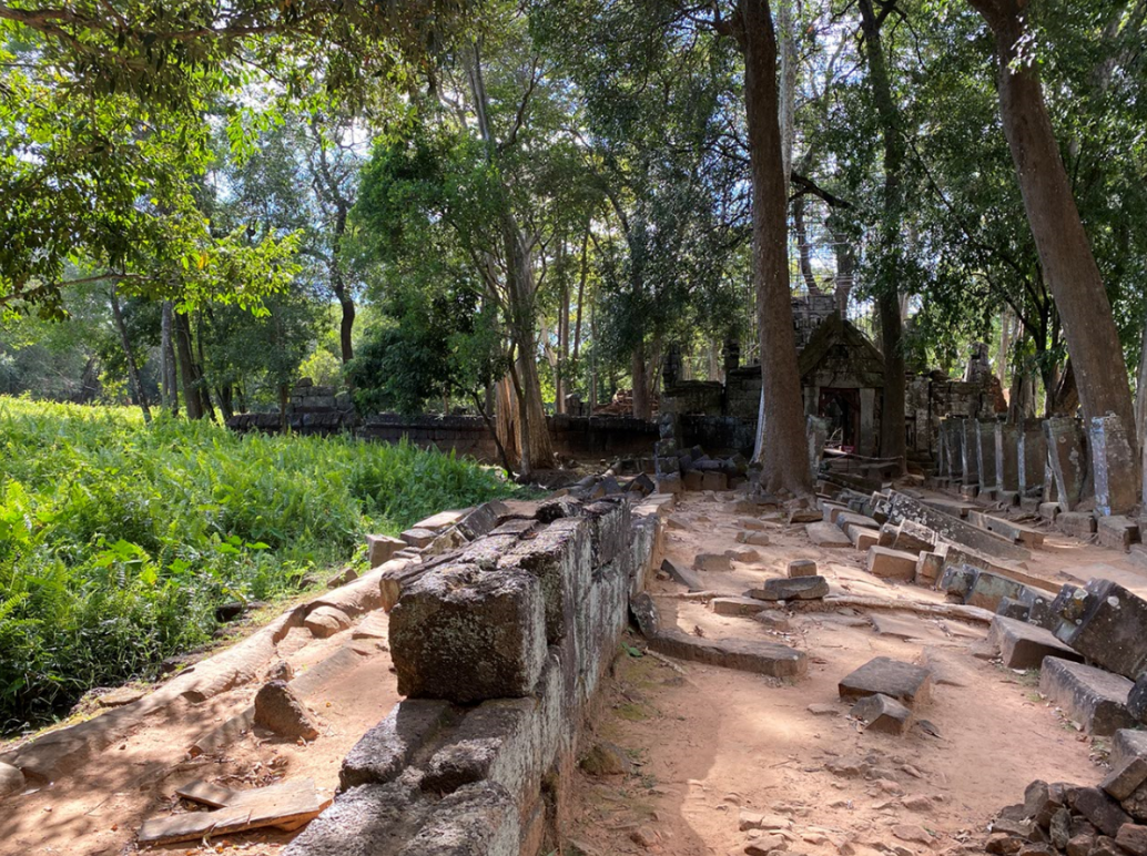
Koh Ker was the political center of the Khmer Empire during the 10th century CE.
ប្រាសាទកោះកេរ្តិ៍ ធ្លាប់ជាមជ្ឈមណ្ឌលនយោបាយនៃអាណាចក្រខ្មែរនៅកំឡុងសតវត្សទី១០
Our mission is to better understand the historical importance and help inform contemporary conservation efforts.
បេសកម្មរបស់ពួកយើង គឺដើម្បីអោយយល់កាន់តែប្រសើរអំពីប្រយោជន៏ប្រវត្តិសាស្រ្ត និងជួយដល់ការផ្សព្វផ្សាយអំពីការអភិរក្ស

Our Team /
ក្រុមរបស់ពួកយើង
We are an international research team with members from Canada, the United States, Brazil, Australia, and Cambodia. Our focus is remote sensing applications and strengths include lidar, ground penetrating radar, and photogrammetry.
ពួកយើង គឺជាក្រុមអ្នកស្រាវជ្រាវដែលមកពីក្រៅប្រទេស ដូចជា កាណាដា អាមេរិក ប្រេសុី ល អូស្រ្តាលី រួមជាមួយកម្ពុជាផងដែរ។ ការស្រាវជ្រាវរបស់ពួកយើងផ្អែកទៅលើការប្រើប្រាស់ឧបករណ៏រ៉ាដាដើម្បីចាប់យករូបភាពពីចម្ងាយ ការផ្ដិតយកទ្រង់ទ្រាយដោយឧបករណ៏ពន្លឺ និងរូបភាពផែនទីដែល
ស្កេនបានដោយឧបករណ៏។

Geophysics /
ផែនដីវិទ្យា
Ground Penetrating Radar probes the soil with radio waves in order to build an image of buried features. Its speed and portability makes the GPR and invaluable tool for field archaeology.
ឧបករណ៏រ៉ាដាដើម្បីចាប់យករូបភាពពីចម្ងាយ អាចចាប់យកដីជាមួយរលកវិទ្យុដើម្បីបង្កើតបានជារូបភាពដែលបានកប់។ល្បឿននិងភាពងាយស្រួលក្នុងការផ្ទេរទិន្នន័យ បានធ្វើអោយឧបករណ៏រ៉ាដាដើម្បីចាប់យករូបភាពពីចម្ងាយមានអត្ថប្រយោជន៏ក្នុងការសិក្សាបុរាណវិទ្យា។

Photogrammetry /
បណ្តុំរូបភាព
Photogrammetry is the process of collecting images of an object and then assembling them in a digital 3D model. Images are collected here through drone imagery and photography.
គឺជាការប្រមូលយករូបភាពទាំងអស់របស់វត្ថុមួយ ហើយផ្គុំបញ្ចូលគ្នាអោយចេញជារូបភាព3D។ រូបភាពទាំអស់ត្រូវបានប្រមូលដោយកាមេរ៉ាដ្រូន និង ការថតរូបដោយប្រើប្រាស់កាមេរ៉ា។